Thursday, December 16, 2010

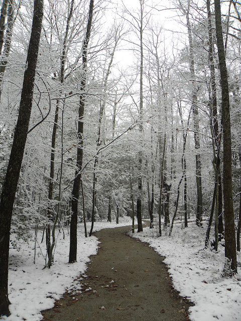
First Snow December 2010

This past week we had the privilege of the first snowfall in the region for Winter 2010. The day was not too cold and there was plenty of wildlife to be captured. During my tour around Greensprings, I came across three different species of Woodpecker, beautiful cardinals, blue birds, a Falcon and many deer. All photographs are the property of this blog and the photographer.


Sunday, October 31, 2010

Historic Green Spring

If you have ever driven out Centerville Road from route 5, you have seen the open fields and signs for "Historic Green Spring".  Yesterday with the National Park Service and the Friends of Green Spring, the site was open for touring.  Thank-you to the wonderful volunteers including Jamestown High School Biology students. 

The site was open with two people in character as Govenor and Lady Berkley.  Historians, Map makers and volunteers were on hand to give presentations on The Battle of Green Spring, named after the Berkley Plantation, but also called the Battle of Jamestown Island.  The Battle itself was fought on what is now known as Mainland farm, Carlton farm and Drummund Field Community. We had a nice look of Maps throughout history which showed where things were in the 17th, 18th and 19th century as well as today.  We were also priviledged to hear about the Greate Road, the road going back 1000 plus years leading from Jamestown Island to Williamsburg.  Another historian spoke on the African American history of the area.  The first slaves in Virginia were at the Berkley Plantation and were later freed by Henry Lee and given a plot of land in the area now known as Freedom Park, a James City County park, botanical garden and display of Slave cabins. 

What was exciting seeing on the sight was the actual Green Spring for which the area is named.  There is still a spring and an old spring house where water still emerges from the ground and then flows towards the other tributaries and into the James.  The sight was chosen for the spring that existed there in the 16 and 1700's and the area named after the spring because having an abundance of water meant the area was green.

THE AREA OF GREEN SPRING PLANTATION

THE GREEN SPRING

OLD SUNKEN ROAD

BATTLE LINES FROM REVOLUTIONARY WAR BATTLE AT GREEN SPRING


GUESTS TO THE INTERPRETATION OF GREEN SPRING

Sunday, October 24, 2010

Church on the Main

This past week riding along the bike trail, I discovered the Church on the Main, a church built in the 1700's. By 1850 it was completely in disrepair and the bricks and headstones had been all removed.  Some 210 graves have been located around the former site for the building.  There is also an Indian Burial site nearby. 


Walk & Talk - Williamsburg Land Conservancy

  Today I enjoyed a "Walk and Talk" by the Williamsburg Land Conservancy Volunteers on Green Spring Trail.  I have discovered that I live on the river bank of what use to be Powhatan Creek 100,000 to 120,000 years ago, the prehistoric area of the James River and the outer rim of the crater which hit the area.  There were several interesting speakers.  I am mostly interested in the history and the formation of the area.  We also heard about the Land Conservancy itself and the Master Naturalist Program.  Thank-you to the WLC for the great afternoon. 

Bird Enthusiast Bill explains about the 210 species of Birds found within the area of Greensprings Interpretive Trail and the importance of the area to find that many species in one place.


Scematic Map of the area for the former riverbed of Powhatan creek and the Ancestrial James River

Archeologist Alaine Outlaw explained the history of the area leading up to the location of the Green Spring Plantation as well as the Battle of Green Spring.  He gave great information on the historical significance of the area.  Mr. Outlaw uncovered the area of "Church on the Main" and the 210 graves located there. 

Walk and Talk participants enjoying the views from the Marsh boardwalk over looking the Marsh lands


Geologist and Professor from William & Mary, Jesse Johnson explains that we were standing in the old pre-historic area of the James River and also 120,000 years ago the river bed for the Powhatan Creek. Looking at land features on my way along the trail home which rises off the trail slightly, our home sits on the edge of the former Powhatan Creek


Tuesday, August 3, 2010

Video of Deer Crossing Trail

This video was taken along with the photos today. Two deer had already crossed the trail, so that is 9 in this group of Bucks that hang out behind my house.

Greensprings Bucks


Group of about 9 Bucks which hang out behind my house at the end of our trail to the Greensprings trail. They are absolutely beautiful.
Posted by Picasa

Captial Trail Buck

Capital Trail Buck seen this morning on the Greensprings area of the Capital Trail.
Posted by Picasa

Monday, August 2, 2010

August has arrived and so has the rain


At least some has arrived.  Just enough to make everything green and the weeds shoot straight up above your head.  These are the lastest photos from this past weekend. There are a few gems in there.  The deer fawns were out.  I saw 5 in all near boardwalks. The new end of the trail which will eventually lead around St. Georges Hundred to Clara Byrd Baker is in the works.